No Watches, Warnings, or Advisories currently in effect!

spacer
Updated: @  
Current Conditions Wind Rain Outlook
Dawn, Dry, Clear skies Dawn, Dry, Clear skies
Currently: 54.5, Max: 54.5, Min: 46.5 54.5°F
Warmer 1.7°F than last hour.

Cool

Feels like: 55°F

24-hr difference
10°FWarmer 10.0°F than yesterday at this time.
  Today Yesterday
High: 54.5°F
5:20am
75.7°F
3:06pm
Low: 46.5°F
3:01am
43.3°F
6:00am
 Calm SSW
0
Gust:
0 mph
Calm
Today: 8.1 mph 2:02am
Gust Month: 20.0 mph July 1
Rain Today: 0 in
Rain Rate (/hr): 0 in
Rain Yesterday: 0 in
Storm Rain: 0 in
This Month: 0.29 in
Season Total: 5.15 in
1 rain day in July.
Saturday

\"$period:
Sunny
Humidity & Barometer Snowfall Moon
Humidity: 24 % Increased 1.0% since last hour.
Dew Point: 18.4°F Increased 2.5°F since last hour.
Barometer: 29.849 inHg  
Baro Trend: Steady
Snow Today: 0 in
Yesterday: 0 in
This Month: 0 in
Season Total: 55 in
Waxing Crescent
Waxing Crescent, Moon at 1 days in cycle
4%
Illuminated
UV Index Solar Radiation
   0.0    None
High: 0.0 @ 12:00am
0 W/m2 (0 %)
High: 0 @  12:00am
 7-Day Forecast
  Saturday

\"$period:
Sunny
Sunday

\"$period:
Sunny
Monday

\"$period:
Sunny
Tuesday

\"$period:
Sunny
Wednesday

\"$period:
Sunny
Thursday

\"$period:
Sunny
Friday

\"$period:
Sunny
  Hi 72 °F Hi 77 °F Hi 80 °F Hi 80 °F Hi 79 °F Hi 78 °F Hi 79 °F
 
Overnight

\"$period:
Clear
Saturday
Night
\"$period:
Mostly Clear
Sunday
Night
\"$period:
Clear
Monday
Night
\"$period:
Clear
Tuesday
Night
\"$period:
Clear
Wednesday
Night
\"$period:
Mostly Clear
Thursday
Night
\"$period:
Mostly Clear
 
Lo 37 °F Lo 39 °F Lo 43 °F Lo 45 °F Lo 44 °F Lo 43 °F Lo 44 °F  
 Ben's Weather Summary - Updated: Friday, Jul 25 @ 11:16pm
Looking at a gorgeous summer weekend ahead with slightly below normal temperatures, light winds, and dry conditions. A trough will remain in place across the west, maintaining the onshore flow as highs reach the mid-70s this weekend, while overnight lows cool to the 40s. We will also experience our typical afternoon westerly winds 10-20 mph. This troughiness will slide east by the first of the week, allowing high pressure to regain control of our weather. This will bring an increase in temperatures with dry weather for now. Longer-range guidance is still bringing monsoon moisture into the area that could generate some afternoon thundershowers later in the week.

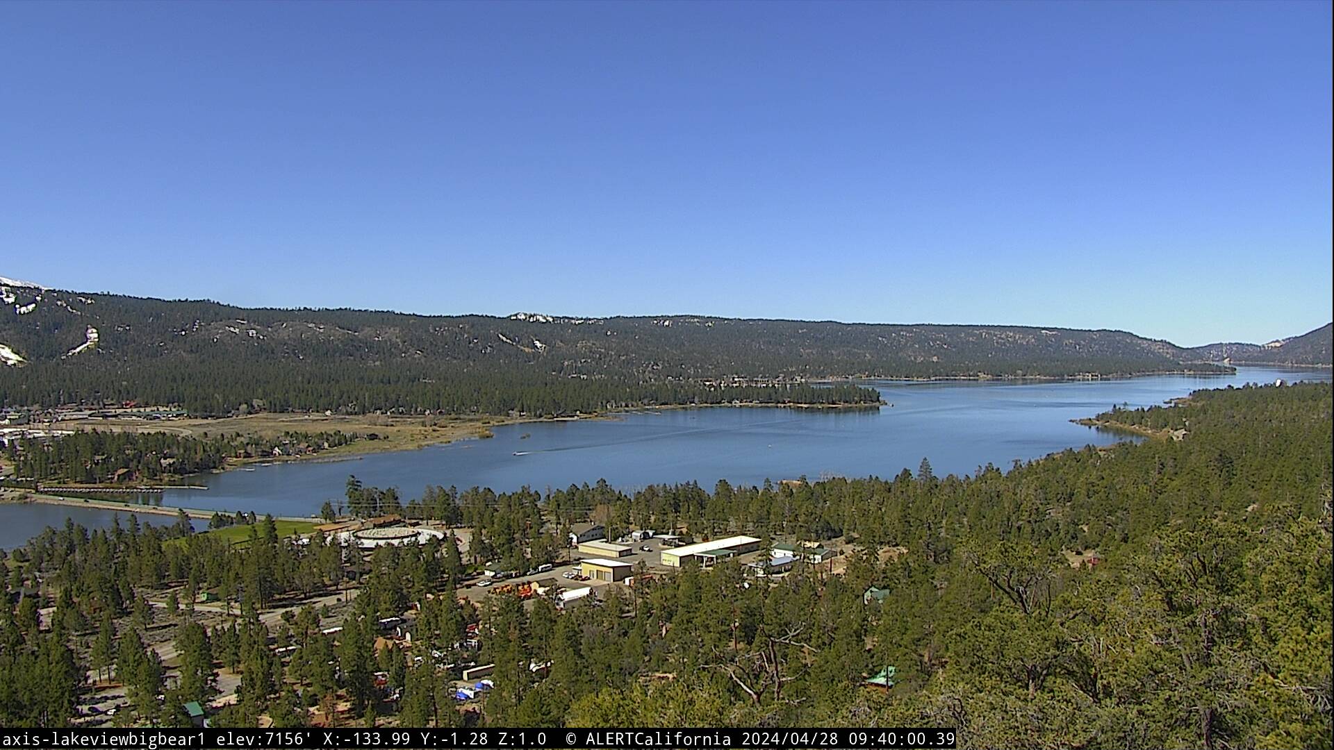
LIVE Big Bear Valley (Elev 8,600')


Custom Radar IR Satellite

Bensweather.com Official Sponsors...